home | presentation | research | the cemetery | chronology | tombstones | 360º views | references | credits | © 2012 Centre d'Estudis Zakhor
| BRIEF HISTORY OF THE CEMENTERY
Located at the east end of Montjuïc, this dense cemetery traces its beginnings to the 9th century, as it appears in medieval documents which mention some ancient Jewish graves -veteres judeorum sepultures- in 1091. Another document from 1368, referring to the Jewish community of Tortosa, mentions the graves in the Cemetery of Barcelona "donde las hay desde hace más de 500 años" (where there have been for over 500 years). The attack on the Call -Jewish quarter- perpetrated in 1391, resulted in the forced abandonment of the cemetery in the late 14th century. The site was looted and the tombstones sold and reutilized as building material. A few of these fragments can be seen in some city buildings.
|
In the early 15th century, King Martin the Humane granted the area of the Jewish cemetery to the Celestinians, a Benedictine order who looked after the Royal Chapel. Subsequently the memory of this cemetery is lost, and only preserved through place names appearing in military-historic mapping mainly from the 17th and 18th centuries. The land, which appears to be under military jurisdiction, should serve as agriculture fields and it margins start being transformed with the quarries for the extraction of clay. |
The constant human activity on this part of the mountain has been changing the landscape over many centuries. Thus, the extent of the necropolis has always been considered unknown, given the difficulty of establishing its original limits. However, in the definition of the boundaries of properties in the general area and the 'place names' we can find the traces that allow to identify and re-draw them.
The
Jewish Cemetery of Montjuic [pdf] |
|
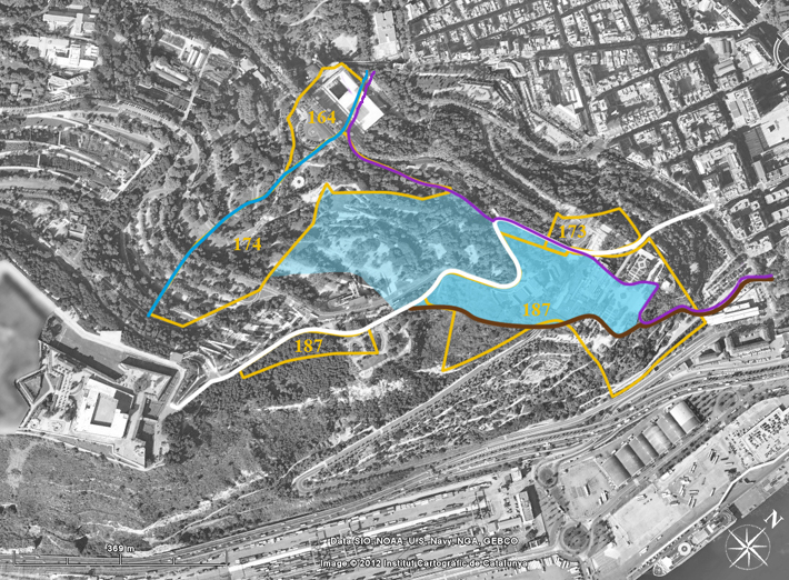
area of study overlay
of 1851 properties plan overlay of 1914 properties plan
plots studied: 164, 173, 174 & 187
graves
found in 1946-47 and 2001
|
|
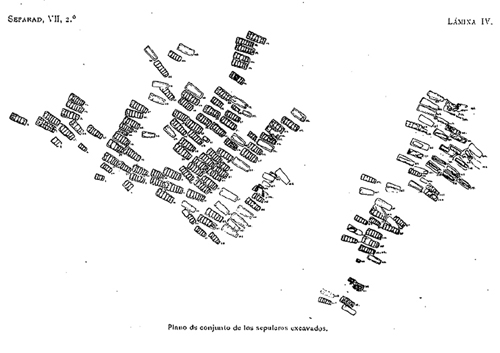
Excavation for the construction Overall plan, 171 graves Durán i Sampere, A. Sefarad, 7:2 (1947) |
 |
||
|
|
||
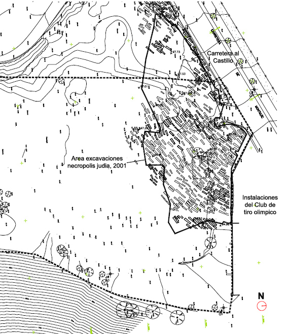
Area of archaeologial excavation 2001 557 graves Gardens on the Terrace of the old Pigeon Shooting field B:SM Montjuïc. Ajuntament de Barcelona
|
|||